This is an abridged extract from ‘Arctic Passages: Ice, Exploration, and the Battle for Power at the Top of the World’, to be published in May 2025 by Island Press.
Buy a copy here.
Two and a half miles to the west sat Big Diomede, 11 square miles in area, compared with the 2.8 square miles of its neighbour. Between the two lay the international date line – Saturday on Little Diomede is Sunday just a short distance away – and a border. Big Diomede is a part of the Chukotka Autonomous Okrug, Little Diomede an outpost of the state of Alaska, the two islands marking the closest point of contact between Russia and America.
There are other differences: Big Diomede is uninhabited save for border guards and the staff of a weather station, denuded of its Native inhabitants by the Soviet Union in the 1950s to avoid repeated contact between those on either side of the imaginary line. On the base of Little Diomede, in contrast, lies a tiny village that clings to the small amount of exposed shore, whose eighty or so Inupiat Eskimo inhabitants survive primarily by fishing and hunting walruses, the ivory tusks of which they carve into ornaments and trinkets for trade and sale. The boundary between the two islands became known as the Ice Curtain; during our visit to Little Diomede in 1998, one resident told us that youngsters in the village would race across the water or the ice, aiming to touch Big Diomede and return without being fired upon by Russian border guards.
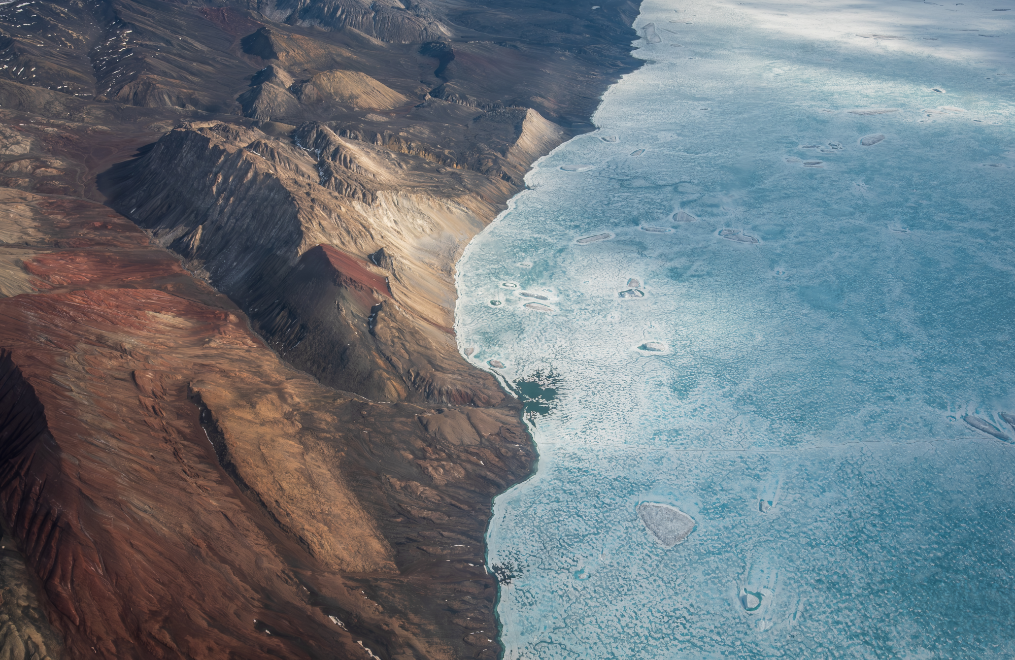
The islands are located in the Bering Strait, a narrow stretch of water that separates the Asian and North American continents and that at its narrowest point is a mere fifty-one miles wide. It is named after the Danish explorer Vitus Bering, who, under commission from Russia’s Peter the Great, first set out from Saint Petersburg in 1725 to sail from the Kamchatka Peninsula on Russia’s east coast “along the shore that runs to the north and that (since its limits are unknown) seems to be part of the American coast.”
Today, the Bering Strait region is occupied primarily by Inupiat, Siberian Yup’ik, and Yupi’it Eskimos, most of whom continue to depend on subsistence fishing and hunting of marine mammals. The strait is an important migration route for mammals and birds: gray and bowhead whales swim through it on their way to and from their Arctic feeding grounds, Arctic terns pause here during their globe-spanning flights between the northern and southern polar regions. Indeed, spring in the Bering Strait is a riot of activity as millions of birds and thousands of marine mammals follow the retreating sea ice north, pursued by polar bears and subsistence hunters.
In many ways, the environment has changed little over the last several millennia. In other ways, it has undergone profound transformations: gray and bowhead whales were hunted to near extirpation in the region, although grays have now rebounded to their pre-exploitation levels and bowheads are increasing in number.
Just south of the strait, in the northern Bering Sea, warming has induced a shift from Arctic to subarctic conditions that has fundamentally changed the structure and composition of the marine ecosystem. Just north of the strait, in the village of Shishmaref, declining sea ice cover is exposing the coast to storm surges and causing the shore to erode at an average rate of up to ten feet per year. On Little Diomede, too, the impacts of a changing climate are being felt, not least in melting permafrost loosening the grip of the cliffs on the boulders that are strewn along their surface.
“Our island is falling apart,” one resident, Anthony Soolook Jr., told me as we looked at it from the safety of our ship. “Last night I had a dream, that the boulders came down and smashed the village.”
There is another change underway as well: incremental so far but potentially far greater in magnitude. The number of ship transits through the Bering Strait each year is increasing: from 262 in 2009 to 555 in 2021. Should warming maintain its trajectory and sea ice continue its retreat, those numbers seem likely to undergo further significant growth because the Bering Strait is the sole Pacific gateway to and from both the Northwest and Northeast Passages.
To sail north through the Bering Strait, you must first sail north through the Bering Sea. And to enter the Bering Sea, you must pass through the Aleutians, a chain of fourteen large volcanic islands and fifty-five smaller ones that reaches out from the southwestern point of mainland Alaska and curves across the northernmost reaches of the Pacific Ocean like a string of pearls. The chain ends with the Russian-owned Commander Islands, on which Vitus Bering met his demise, but the bulk of them are Alaskan, and because the westernmost of those, Semisopochnoi Island, is on the western side of the 180-degree longitudinal meridian, Alaska is effectively both the westernmost and most easterly state in the union.
For at least four thousand years, the archipelago has been inhabited by the Aleut people, who refer to themselves, depending on from which end of the archipelago they hail, as Unanga or Unangan; they numbered an estimated 25,000 when Russian fur hunters first arrived on the islands in Bering’s wake, before the population plummeted to just a couple of thousand as a result of violence inflicted and diseases introduced by the invaders. Today, close to 12,000 identify as being Aleut, while 17,000 or so claim at least partial Aleut ancestry.
The Aleuts were even caught in the crossfire of World War II. The 45 Native inhabitants of Attu Island, in the chain’s far west, were captured as prisoners of war and sent to Hokkaido when Japanese forces invaded and occupied Attu and neighbouring Kiska Island in 1942; the United States government evacuated much of the rest of the island chain and sent 880 Aleuts to internment camps in southeastern Alaska, where almost 100 of them died.
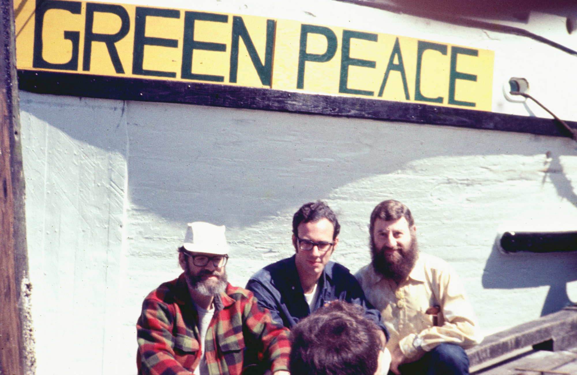
One of the Aleutian Islands, Amchitka, was selected by the US government as the location for a trio of atomic bomb tests from 1965 to 1971, the last of which was the largest underground test ever conducted by the United States. Concerns that the shock waves from the detonation would send a tsunami toward the Pacific coast of North America prompted a group of Quakers in Vancouver to hatch a plan to sail a ship to the test site; calling themselves the Don’t Make a Wave Committee, they signed off one planning meeting with the word “peace,” prompting one of them to add that they should make it a “green peace.” And thus was one of the world’s largest environmental organisations born.
That first Greenpeace voyage never did reach its target, foiled by the attentions of the US Coast Guard; not until 2009 did a Greenpeace ship finally arrive at Amchitka, by now a nature reserve, with me onboard, as part of a broader investigation into the ecosystem of the Bering Sea region.
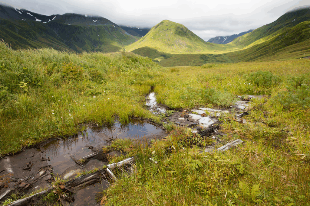
We scrambled across the kelp-covered rocks ringing the island, made our way past the leftover military materiel, and stood on the shores of the lake that had been formed by the 1971 blast, looking off into the distance and, in a silence interrupted only by the rustling of grass in the wind and the occasional chirp of a passing bird, contemplated the violence that had been visited on this remote outpost.
In addition to the prospect of a tsunami, one of the strong motivators for the protest was the possible impact of the blast on the region’s sea otters – of which, during our visit, we saw hardly any. Having long since been greatly depleted by fur hunters, the sea otters of the Aleutians have now further fallen victim to the profound changes in the Bering Sea ecosystem, their continued decline partly fuelled by orcas, which had previously paid little attention to the aquatic mustelids, turning to them for nutrition when their traditional prey of whales and sea lions became less numerous as a result of a combination of human predations and the disruption caused by overfishing and warming waters.
As sea otters diminished in number, the urchins and abalones they ate in vast numbers – a single sea otter being capable of consuming as many as one thousand urchins per day – multiplied rapidly. Unchecked, they laid waste to the area’s kelp forests and then turned their attention to the coralline algae that blanketed the cold-water reefs on which those forests once stood.
Something similar had happened in the past, of course, when fur traders hunted the region’s otters to near extirpation; one difference this time is that warmer waters are more acidic waters, and the greater acidity has chipped away at the resistance of the algae’s reef skeletons. At the same time, the extra warmth increases animals’ metabolisms, making the urchins even more voracious. And ultimately, of course, when the sea otters declined in the past, the fur hunters moved on, allowing the otter population to rebound and the ecosystem to recover.
This time around, the pressures are, if anything, only increasing, as a warming world is all too widely seen as at worst an inconvenience to be endured and at best an opportunity to be exploited, rather than what it truly is: a planetary experiment the impacts of which are even now only beginning to be felt.
‘Arctic Passages: Ice, Exploration, and the Battle for Power at the Top of the World’ breaks down how longstanding geopolitical rivalries have influenced climate crisis in the Arctic. Buy a copy from Island Press here.
Kieran Mulvaney is a journalist who has written for National Geographic, The Guardian, The Washington Post Magazine, BBC Wildlife, New Scientist, E Magazine, and other publications, and has authored three books. Born in England, he spent several years living in a cabin in Alaska and visits the Arctic and subarctic regularly. He now lives in rural Vermont.